Better late than never, here is the report from my hike to the Indian Mounds on 01/14/17. If you are interested, check out the video below to see a timelapse of the hike to Heifer Mound.
The fishing has been slow the early part of the shad season, and I decided I needed a change of scenery, even though folks are having 1-2 fish days near the Econ. With hopes of finding good current with some depth, and potentially finding shad that had decided to pause there, I decided to make the 3.2 mile hike through the Charles H. Bronson State Park to an area known as Indian Mounds on the St. Johns River. This area is peppered with mounds that were created when ancient Indian tribes discarded the mussel shells they ate. These mounds are now grown over, and most of them have palms that can be seen for miles. One exception is Heifer Mound, which is completely void of trees, so I decided I wanted to see that with my own eyes.
I left around 9:00am from the Trailhead at the end of Curryville Road. I started my walk and within just a few minutes, I startled 8-10 deer and they went flying across the road about 20 yards in front of me. I guess there is a reason this area is known for its hunting. If you are interested in making this hike, check the hunting schedule here before making plans. The trail here is a simple service road, and is well defined as hunters with a permit are allowed to drive to their destinations in season. The road is flat and basically takes you through several pastures along the tree line. This hike is not technical, just stay on service road #3 for just under three miles and you will come across a 3 way split. Two of the three are service roads, and the last is a little less clearly defined. You will see a fence to your left, a gate nearly in front of you, and a gate off to your right. Walk in the gate that is nearly in front of you and you notice a lesser defined path that leads along the fence line to a rise with a large oak and palm trees on it, that is Saddle Mound, and from there you can clearly see Heifer Mound.
It took me about an hour and a half to reach Heifer Mound. I took my time, stopping to take pictures along the way, so I would say this could be done in an hour. I also started down the path upstream and changed my mind. Think about it this way… how long does it take you to walk a 5k? If you don’t doddle (like I did) and as long as the water is low and roads are dry, it is no more difficult than walking a 5k. Take a mountain bike and you could cut that in half easily, even with 15-20lbs of gear on your back.
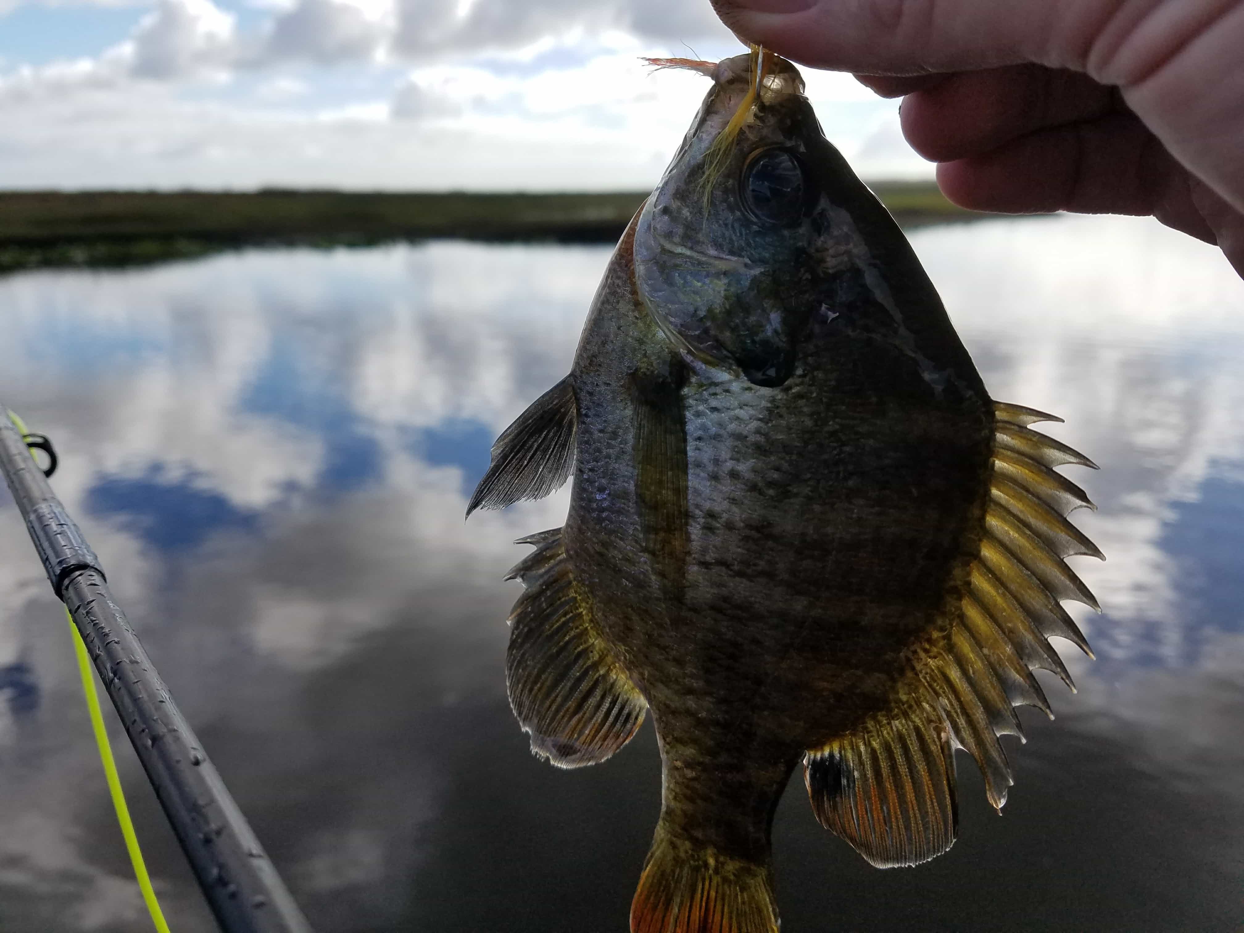
The river near Heifer Mound did not seem to have much current so I headed downstream. Here I found several turns where the current was substantial and the water was deep on the outside cuts. I was able to swing a polyleader and hourglass eye fly without issue on each of the turns. When I did not hook up with shad, I switched to a beadchain eye fly paired with a polyleader and then eventually removed the polyleader and fished with just the beadchain eye fly. When that did not work, I swung an unweighted fly. I caught several panfish with just the beadchain eye fly and the unweighted fly. While “Crappiepalooza” can be fun, that was not why I was there and moved back to the heavier setup. I methodically fished each turn this way for nearly four hours, up past Nellie Dora Mound and did not catch shad.
At about 2:00 I could see a larger front coming in and the wind picked up to about 15-20mph. It started to pour rain, so I donned my poncho and packed it all up. I made the trip back to the trailhead in a little over an hour. In all, I covered nearly 12 miles, and never sat for a rest. I was ready for a whiskey when I got home!
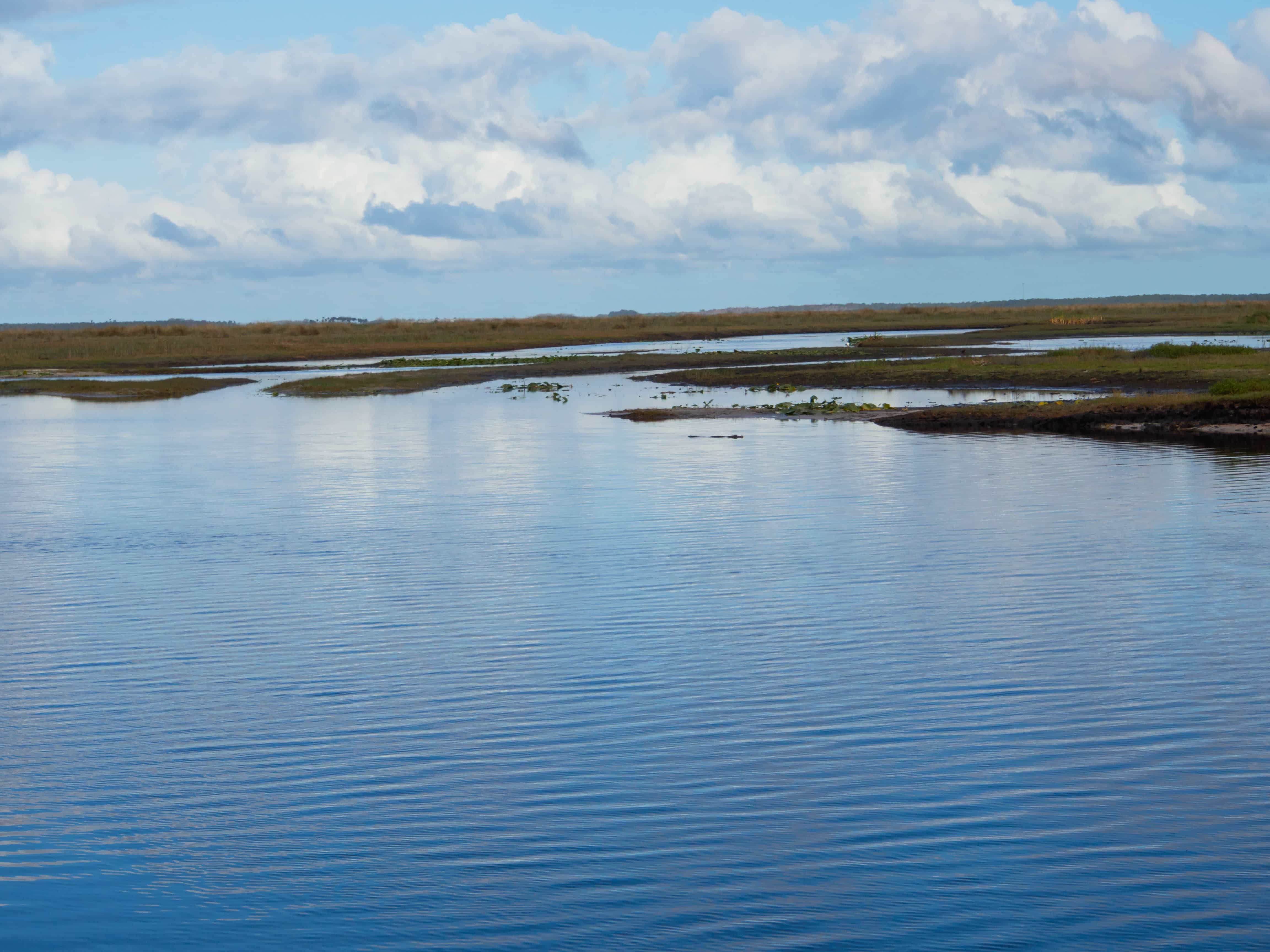
While I did not catch shad on this trip, I very much enjoyed the hike, and would definitely return again, although most likely on a mountain bike. I could see why shad would spawn in this area. There is good current and deeper water on the turns. I also enjoyed the remoteness of the area. I only saw a couple of boats early in the day and just two airboats during the afternoon.
The view is gorgeous in this area and the wildlife is plentiful. You can see for miles as the terrain is so flat. I saw hundreds of sandhill cranes, white pelicans, herons, ibises, and kingfishers. I saw deer and of course tons of cattle. I was surprised to only see two alligators the whole day. If fact, I saw more alligators the last time I was out with Todd when we explored the mouth of Puzzle Lake. No complaints here.
Hopefully the fish start to arrive in better numbers this week. Decisions, decisions… where will I go next? 🙂
Here is a map of the area that I hiked today. Many thanks to Luc Desjarlais and Tom Choma for the time they spent exploring these areas, and for sharing their knowledge with others that are willing to venture off the beaten path.